Day 8 – the actual end is in sight

Day 8 – Five hours later, and I was ready to go. Kinlochleven was dispatched easily, and then I started the long walk up the dam access road, and then the West Highland Way. I was in no position to pedal, my legs were in bits, so walking became my only option on the steep start to the climb. I reached the top, and then slowly began the descent. I was careful not to be too over-exuberant on the ride back to the Kingshouse, conscious that a mechanical would have been disastrous for my week of riding. I would have cried if I’d have broken my bike at this late stage!

The Kingshouse, as tourist friendly as ever, were full of tourists but unwilling to serve food of any sort, nor any cans of Coke or any other such delights. I started on one of my last flapjacks and pressed on. Glencoe ski resort loomed, their café being recommended by another rider. The climb up to the car park just seemed like extra ascent that I really didn’t need, so I missed out on the opportunity for a good feed and kept going.

That climb I so loved at the start of the race became a lovely descent, walkers moving out of the way to let me descend at a decent pace, and Rannoch Moor was soon dispatched. Inveroran and Bridge of Orchy were passed through, and I only had the last few miles to go. Once I’d crossed under the railway line, I knew I only had one challenge left – carrying my bike over the fence closer to Tyndrum.

That challenge came and went, and then all that was left was an uphill push, and then a doubletrack back into Tyndrum. I was conscious that my friend had abandoned his West Highland Way ride at this point with a fall, but I just kept rolling down the hill at speed. The track got close to the road, and I knew I was nearly at the finish.

I got to the village hall at Tyndrum, it being a welcome sight after a week out in the wilder parts of Scotland, and then it was over. No fanfare, no welcoming committee, just waiting around for a few minutes for the Spot to register my arrival, and then down to the shop to commence the refueling process.

7 days, 4 hours, 15 minutes.

I did meet up with another rider, Alan, who had been in Tyndrum for a few days after crashing out on day 2 in Fort Augustus. We got in a couple of pints and a hearty lunch, and then that was my Highland Trail Race over… for this year anyway.

He did get a photo of me by the finish – I don’t look too destroyed here, but I felt it!

Not looking too bad, all things considered...

Day 7 – the end is in sight

Day 7 – This was it, the last day I’d planned for. I was intending to ride from this morning right to the finish in one go. It didn’t work out like that, but that was the original intention…

Leaving the bothy in good time, I started packing my bike. A flat tyre. Damn! Tubeless is meant to stop all this, but here I was with a completely flat tyre. I pulled the tyre off the rim, which was dented and thus no sealant would work. Out with the Leatherman, I bent the rim as straight as I could and attempted to fit a tube. However, no tube would fit as the amount of rim tape I’d used to get the tyre to seal prevented the tyre from mounting again. Time to remove some of that tape, and repeat.

An hour after I’d expected to leave, I was on my way, gingerly riding the rocky path aware that a puncture would be unthinkable at this stage in the race. Glen Affric is an awesome place, and with some regret at not seeing all of it last night I pressed on. I was aware of two hills ahead of me, then Fort Augustus. Both hills were dispatched easily enough, mostly rideable but on decent powerline roads so the going felt quick.

Fort Augustus arrived, not before some lovely and unexpected singletrack in the final approach. A stop at the petrol station / supermarket for flapjacks, and then I was on the Great Glen Way to Fort William.

If ever anyone was to ask which is better, the West Highland Way, or the Great Glen Way, the asker would only have got as far as “Great Gl…” before I would have answered with the former. There was nothing at all to recommend the GGW, it truly is a boring trail comprising fire roads, canal towpath and old railway paths.

However, what it lacked in finesse and enjoyment, it made up for in speed. I was quickly at Fort William, but I opted to avoid its attractions (even the McDonald’s that I’d been looking forward to for days) instead filling up on flapjacks at the petrol station near the Glen Nevis road.

It was 9pm, and I was in no mood to stop – yet.

This was the home stretch. I’d ridden this section as part of my training, doing the West Highland Way over a couple of days a few months prior. It was getting dark as I climbed into Lairigmor, and I got to the dogleg that signaled the section towards Kinlochleven. A straight run from here, although it was pitch black and I’d been on the go for 16hours. I was tiring, and with my aforementioned brake and leg problems it was time to pause.

My genius plan – put on my warm jacket, get out the bivi bag, keep my shoes on, then sleep for a few hours and be fresh and ready to go, then I’d make my way back to Tyndrum in time for a sub-7day finish.

What actually happened – I curled up in a nice space, but awoke an hour later freezing. My bivi wasn’t anywhere near windproof enough, and I should have used my sleeping bag too. I decided to descend further out of the wind, and find more appropriate shelter. That came in the form of a bush with some grass under it, so I took out the sleeping bag and made camp for the night.

Day 6 – Torridon time

Day 6 – Food supplies were starting to run low. I knew that I’d be short of snacks if I didn’t get anything in Kinlochewe. I set out early enough in the morning, knowing I’d have about 11 miles on the road, a stop, and then another 11 miles on the road into Torridon. No matter, it was a quick way of dispensing with 4% of the route distance. I’d got quite accustomed to doing mental arithmetic when out on the ride, mainly as my speedo was in kilometres, and also to keep me from going mad.

Arriving in Kinlochewe, I stopped in at the petrol station, picking up a pile of snacks of varying calorific content and quality. Moving on towards Torridon, I’d regretted that food stop immediately. The Whistle Stop Café appeared around the corner, and I figured after the mild disappointment of the petrol station I should stop here too and get some proper food in as well. They were not yet open, but a short wait for a good feed in preparation for a long day would be wise.

I charged my phone while placing my order. A call to my wife to catch up (the lack of payphones having affected my morale somewhat), and she gave me a piece of news that hit me quite badly. Nik had scratched just outside Ullapool two days prior, and the movement I’d seen was his last on the race. I had really wanted to see him complete the race, he had been riding stronger and faster than I all the way, but it was just my hours in the saddle that let me keep up with him.

Coffee, orange juice, two bacon rolls and my favourite ever bowl of porridge later, and I was on my way. Definitely worth stopping in, it’s a lovely wee café that does great food and is most welcoming to stinky bikers at any time.

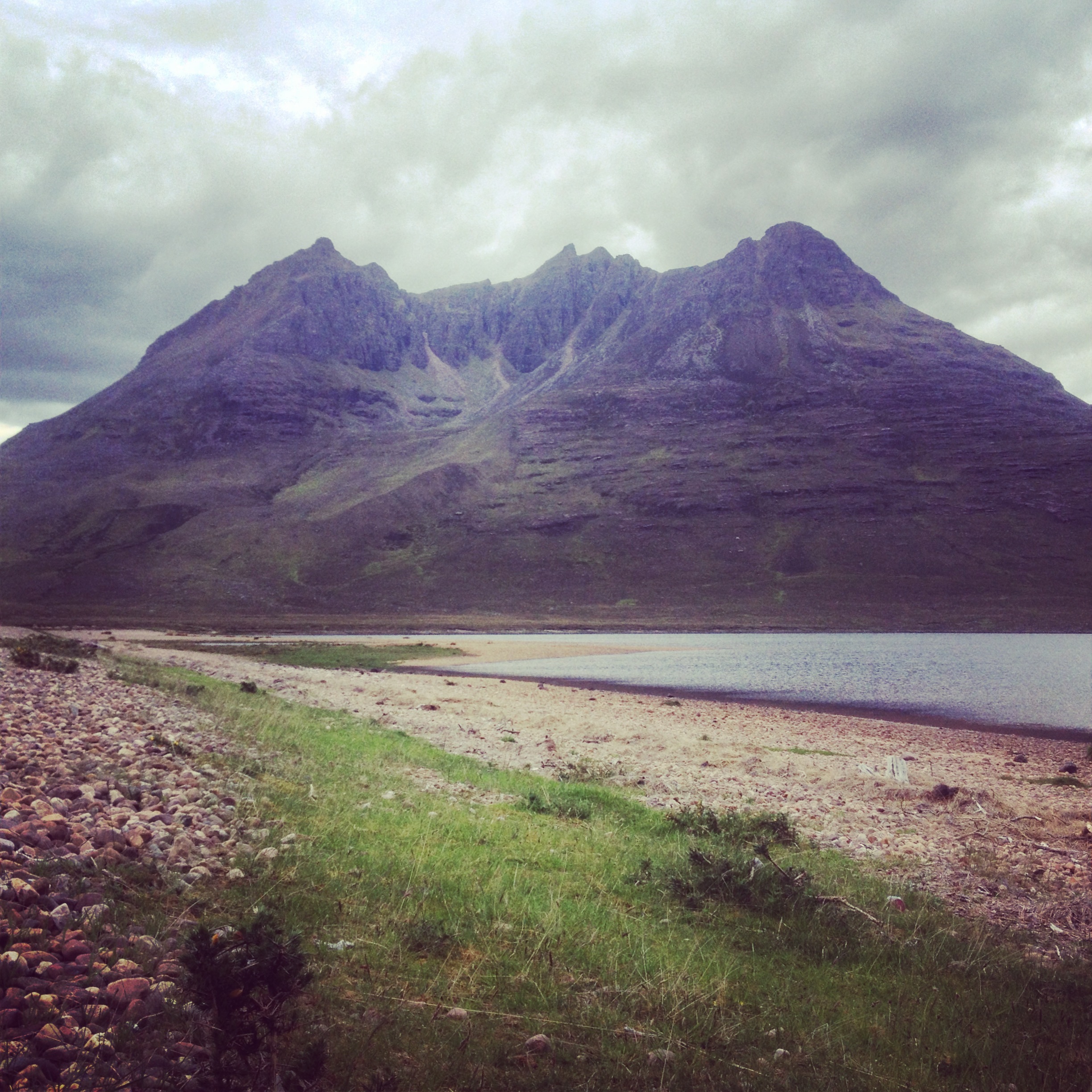
Eleven miles of road passed in no time at all, and I was approaching Torridon. I had been looking forward to Torridon as it’s a region I’ve never been to but have heard a lot of good things about.

View to Annat

I started on the push up hill occasionally pedaling where I could. I overtook a couple of backpackers on the smooth rock section, and then promptly fell off. Nothing serious, and if you can laugh about it then there’s no harm done. I kept leapfrogging the walkers, eventually reaching a cyclist stopped in the distance.

“Highland Trail?” said the mystery cyclist. Clearly news of my impending arrival had travelled far. This was Jon, a fellow bikepacker and originally an HTR rider, out for a spin, having followed a few of our SPOT trackers. He had ridden the Bealach Horn in atrocious conditions to ‘preview’ it before the race, but deciding once was enough! We had a good chat about the ride so far, and I bid him farewell. A really nice guy, and it was great to speak to someone out there who wasn’t on the race and yet knew what we were doing. Definitely one of the high points of the day, and it was the little things like that which made the race.

Arriving at a lochan, I got stuck into lunch.

Torridon lunch stop

Sitting out in the sunshine, I felt like having a wee snooze, but common sense got the better of me and I pressed on. I was in high spirits, having started Torridon and pushing my way into what should be a fun descent. I didn’t realise at the time, but the next part was going to be the point that nearly broke my spirits.

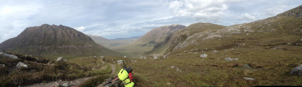
Yet another pushing climb on poor surface, I figured that I was nearly at the end of it. That descent must start soon, it must! Nope, another bealach first, and then the trail opened up into an open coire – this would be prime scenic bivi territory had it not been lunchtime.

In this coire, I realised there was no way out of it on the path other than by climbing over the lip. I do mean climbing – this was a case of putting the bike onto the next stable part of the path, braking, and then using the bike to pull me up. It was hard going, lifting a heavy bike, pulling up on the bike, repeating.

My partial meltdown came in me shouting out some choice words of constructive feedback for the course organiser. It felt good to express just how horrible this entire climb was, and I felt somewhat foolish when I reached the top. However, it was the top, so if anything having a moan about it gave me the impetus to keep going up.

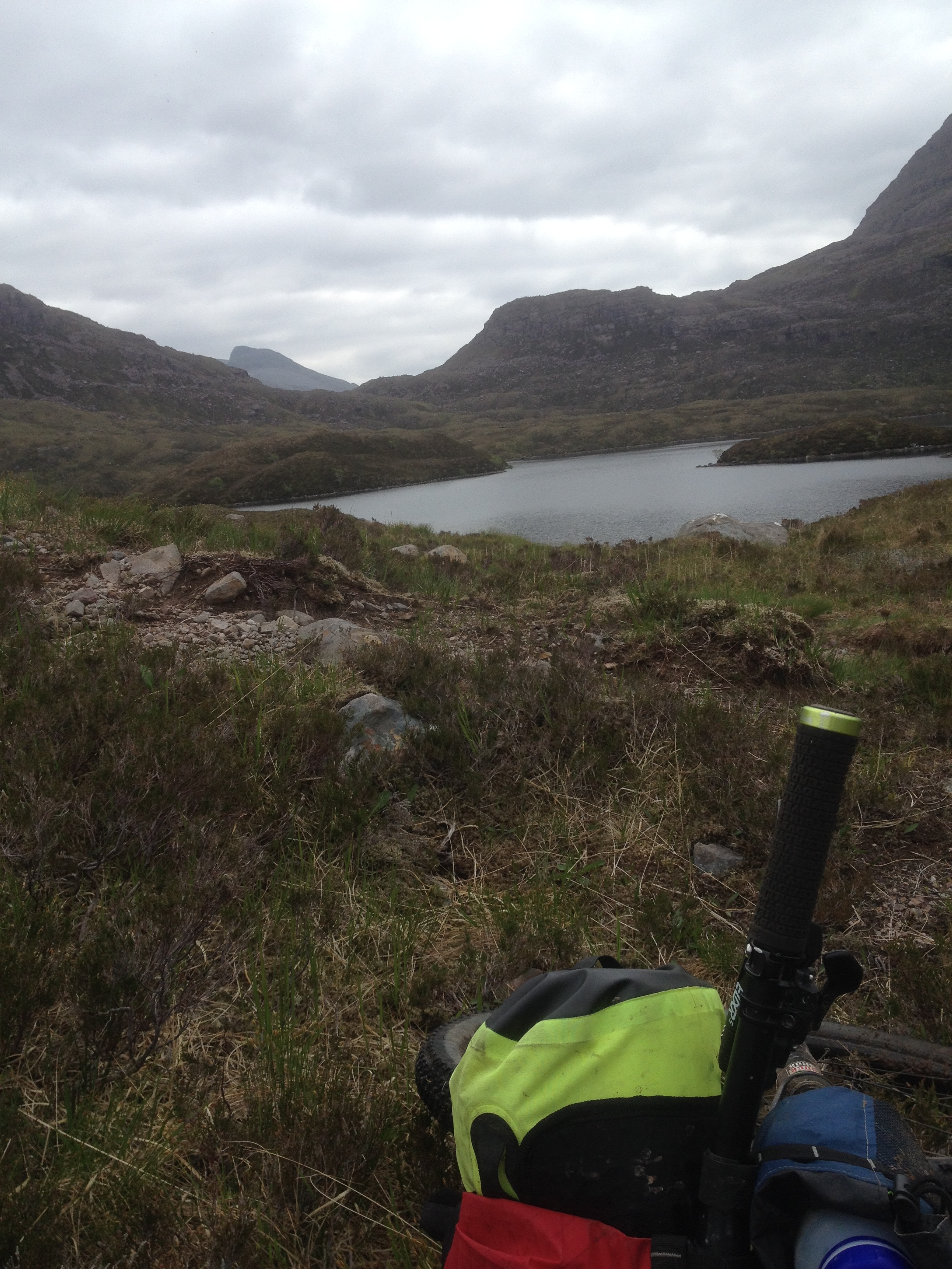
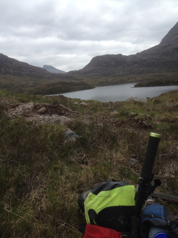
I think the photo below is of the top of Coire Lair, but don’t quote me on that…

Coire Lair??

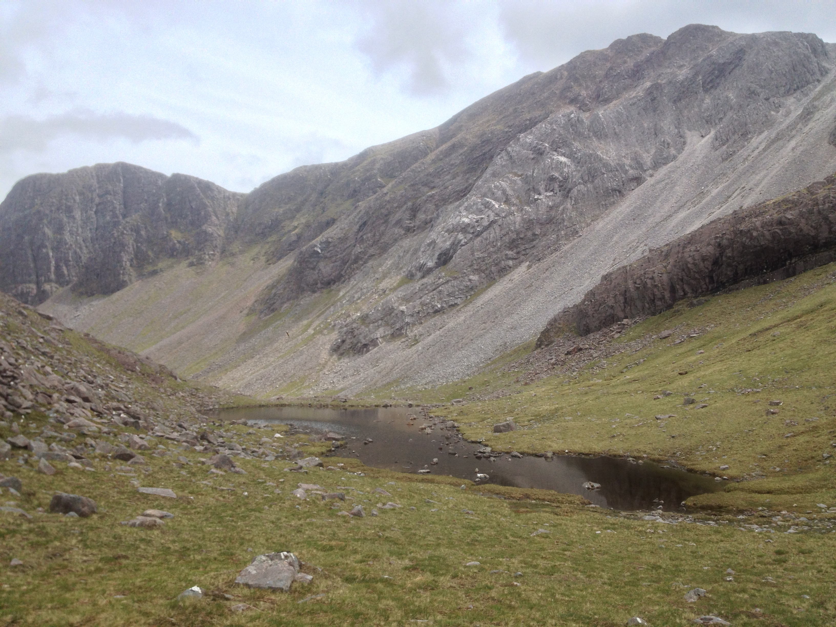
Coire Lair was a good descent, perhaps a bit too techy for me in places, in part down to the self preservation due to my location. If I had a bouncy bike, and wasn’t so laden with luggage, I’m sure I would have ridden more of it. I did however feel the brakes boil, and the performance of the rear was never going to be perfect for the rest of the trip. Oh well… not enough to cause me to scratch, but it was going to be a concern.

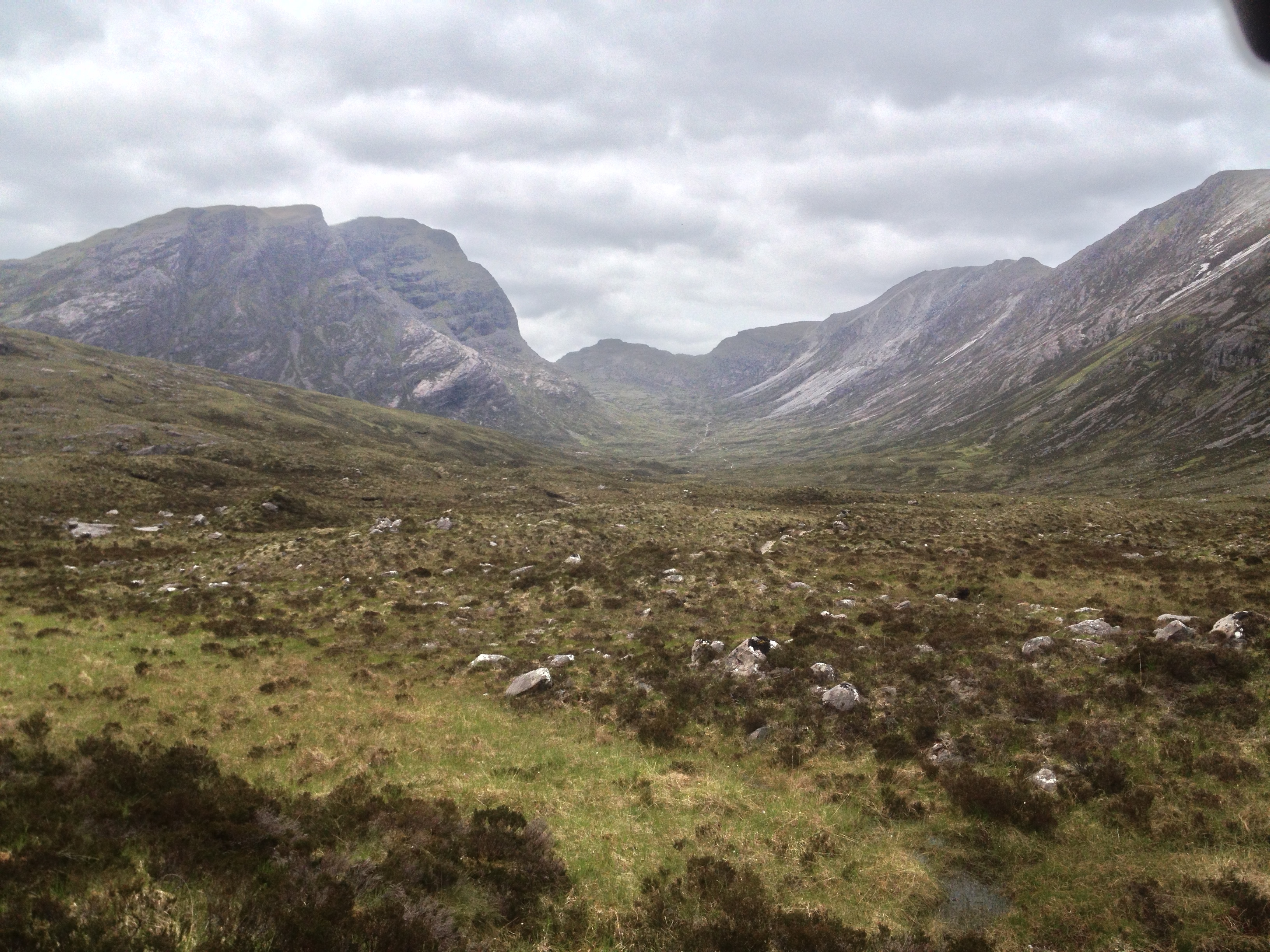
The photo below looks like a normal glen, but look closely (might need to zoom on the linked image) and you’ll see the ribbon of trail in the dead centre. This is what I’d just ridden down. Tee hee.

IMG_1922

Having survived Torridon intact, I was feeling a bit peckish and the road miles to Strathcarron only intensified that feeling. The hotel did not do hot food in the afternoon, but they did do cake. A supreme sacrifice was made, and I received a slab of chocolate fudge cake. I got chatting to the bar staff, who had been following the race. The last racer to pass through had been a full day ago, so I was well and truly on my own. The collective opinion of the bar staff and customers was that we were lunatics for doing this race, and at times I was beginning to think this myself!

A steep road climb out of Strathcarron was followed by a mere 1000ft of ascent and descent to Dornie. I decided to avoid the village and continue on, hoping to do a good chunk of Glen Affric that day and carrying sufficient supplies to see me a good distance.

Leaving the road at Morvich, I started the climb into Glen Affric, not knowing what to expect. Was I wise to attempt a high pass in the evening, or should I have stopped there and done it in the morning? However, this is the HTR, and I had learned enough to know to keep going until it was dark.

Good doubletrack to Glenlicht House, was followed by singletrack mixed pushing and riding. As night fell, three glorious waterfalls could be heard and then seen on the way up, but photos would have been impossible in this light. Headtorch on, and I realised I needed to continue to the bothy as the wind was picking up and the temperature dropping.

At 11:30pm, I arrived at the bothy. No bikes outside, and only one person inside. As this was a two room bothy, this was perfect. I had a room to myself, so I quietly set about the process of feeding, unpacking and then sorting out my sleep. The last of my couscous and a bag of porridge for dinner, then sleep.

Day 5 – Fisherfield fun

Day 5 – I woke up feeling refreshed, and with the realization that I was halfway through the distance I felt for the first time that I might actually finish this ride. Meeting up with Nik in a café, he was taking a relaxing breakfast waiting for the chemist to open but I decided to press on. However, I knew that Fisherfield was ahead, and the twin peak ascent profile of the next few miles was something I’d been dreading for the whole route.

After a few miles on the busy main road, I turned off and headed towards the start of the doubletrack ascent. After the path disappeared into vagueness (it’s across the far-left corner of the field) I then followed what I thought was the path up-stream. However, I’m guessing a fellow competitor made the track I was following as it soon petered out into nothing. It turns out my route was wrong, and I should have followed the obvious double track instead.

Pushing uphill, I got to a point where I needed to call on the can of Coke. I stopped to check the positions on the trackleaders side; Nik was moving so I decided that as it was a race so should I. Reaching the top of the climb (which was horrible), I then faced up to the descent down the other side. Fast, slow, dry, muddy, slippy – it had it all, but I was soon back on the main road I’d come off, albeit on the other side of a bloody big hill.

One hill down, one to go. This next hill started off quite nicely, with a gentle doubletrack climb, but it soon got steeper. It didn’t feel as bad as the last one, perhaps due to the can of Coke and other foodstuffs I’d consumed. At the top, I stopped for a couple of photos and then made my way down towards the bothy at Shenavall.

Into Fisherfield

This was a change to last year’s route (which I didn’t get to experience anyway) following some ‘constructive’ feedback about the brutal descent the riders endured. This one by comparison was a good fun descent on good doubletrack followed by a path following the river to the bothy.

It was only early afternoon, so no point in stopping at the inviting bothy, so I pressed on for the loch crossing. This is an optional part of the route, in that if you don’t do it you double back and then take the road round, which will likely take a lot longer.

Instagrammed river crossing

However, today wasn’t a day for turning round, so I took a walk of faith out into the loch to find the shallow crossing point. Despite it seeming counter-intuitive, the best way out was to walk out into the loch on a sand delta (thank you Google Earth) and then back in again at the halfway point. The water was thigh-deep, so a lot better than I’d expected.

Climbing up a track alongside a river, I realised I’d need to climb back out of this valley, and the climb soon presented itself. A long push ensued, finally topping out (image is the banner to this site) and then traversing a couple of miles before the view of the next descent presented itself. I was going to enjoy this. Hopefully the photo below (another Instagram special) demonstrates the trail on the right nicely.

Descent out of Fisherfield

I realised that I had made the right decision in getting rid of the rigid fork for this ride. I also realised that this was the sort of descent best enjoyed with other people, because it was steep, fast, technical, and remote. On my own, I set off down this snaking ribbon of trail, having to rein in my speed as it was sketchy in places. 300m in 2km – another good section, in fact one of the most rewarding and just plain awesome descents of the ride so far.

I arrived in Poolewe, hoping to find a bed for the night. I had been spoiled the night before, so wanted to wimp out and get another good sleep. However, this was not to be, as once again there was no room anywhere. I decided to ride on for a while to see what the path yielded, at this point having only forty miles in my legs.

The Tollie Path loomed – I didn’t know of its notoriety until after I’d finished. Probably a simple path across to Loch Maree, an up and down, and then some road riding to Kinlochewe in time to pick up some supplies. There are no simple paths on the Highland Trail Race. This path started off nicely enough, in fact the entire climb was bearable enough. However, reaching the high point, I realised the descent was not going to be as fun. When you have to walk descents, it stops being fun. Night was falling, and I gingerly picked my way down a mass of boulders, rocks, stones, pebbles and sand. Occasional rides served to combine with not-so-occasional walks, dragging the bike all the way. However, with an end in sight, I reached the shores of Loch Maree eventually, riding a forest path towards my intended campsite, the space near the public toilet on the map.

Too many campervans were around for me to unfurl the bin bag, so I kept going, trying as I might to find a decent place to stop. Eventually, when I realised the main road was coming up, I found a clearing in the forest off the access road, its high and undisturbed grass indicating that I would be unlikely to be run over by any reversing cars. Either way, the bike went closer to the road than I, just in case.

Necking some food, sleep arrived quickly.

Day 4 – reaching the home straight

Day 4 – Ullapool represented the halfway point on the HTR430, and I saw it as being the target to reach within half the time to have a chance of finishing the HTR550 within the 8 days. It’s farther than halfway on this race, but the ascent profile gets a lot more severe from here on in so I realised I would need that extra time for all the pushing ahead.

I knew that I needed to stock up on food, and the Drumbeg store came highly recommended by pretty much the entire Internet. I realised I was only a few miles from it, so no point in getting up early to arrive before it opened. Bad move. While it’s only a few miles, the road gradient is so steep (1 in 4 in places) that I made very slow progress. I arrived at the shop, and it was indeed brilliant. The best flapjacks of the trip (the little things in life…), fresh bread, and loads of other niceties.

The owners are lovely as well, great chat too. I mentioned the race, and they said another rider had been through the day before – I figured it was Nik. I was getting ready to leave, and suddenly Nik appeared – he had stayed in a B&B in Kylesku, getting the little old lady owner to wash all his bike gear. Meanwhile I’d slept in a layby under my tarp in all my bike gear. Swings and roundabouts…

We rode together to Lochinver via some truly sublime singletrack that follows the shore. Lochinver has the Pie Larder – the best pie shop, anywhere. Every good route needs a pie shop. Some good routes even have a Pie Town, but that’s hopefully going to be another story someday…

The next part I knew was going to be hard, and with hindsight it was the crux of the route. 10 miles in 5hrs – not nice going. It started off so well, rideable singletrack, then it descended (not in a gradient sense) into dragging a bike over rocks, pedaling a few yards, then repeat. Anything up to this point was easy and enjoyable by comparison – this really was a mentally testing section as you couldn’t see an end in sight…

The road at Ledmore Junction was eventually reached, and I lay down partially in relief that it was over. Horrible!

I rode on to Ullapool in one push, deciding not to stop at the Oykel Bridge Hotel. A nice doubletrack ascent past a lodge of fishermen, eventually arriving above Ullapool as night fell. There then followed some lovely fast singletrack into the town, and I got in at about 10pm. No rooms anywhere (and I’d checked every pub, hotel and hostel), so I resigned myself to a night in the bivi. Sitting on the sea front, eating my Indian takeaway, Nik appeared, and then disappeared into the night to find the campsite. I got back on the route, and found a hotel just outside Ullapool (sorry Nik!!), and took the opportunity to clean my biking gear and demolish the free shortbread and hot chocolate before passing out in the comfy, warm, soft, comfy bed – luxury.

Day 3

Day 3 – the rain was still light in the morning, but there was no wind. I climbed through the same valley as last night, and came across an occupied hunting lodge. At this point, the trail started to descend, albeit gently, but it was still a descent. I checked my map, and could see a phone box at Croick. I decided to press on until then, and phone my wife from there and eat a second breakfast at the same time.

No such luck – the map was correct in that there is a phone box in Croick, but no phone. This was a theme that would be repeated many times during the race.

I took the Ullapool ‘road’, turning off towards Oykel Bridge on some lovely singletrack. It was a stream in places, but the bike handled it well, climbing everything with ease. At Oykel Bridge, there is some road to Rosehall, the last shop for miles. The shop was a sad sight, not much stock on the shelves, but there were pastry goods and biscuits, so all was not lost. Rosehall became Glen Cassley, and then the power station road climb (would have been fun unladen and especially on a road bike) and a long and fun road descent to Loch Shin. This was my first “wow” moment of the race, as the scenery opened up and I remembered just why I love riding my bike in Scotland.

You might have noticed by now the sheer lack of photos – I didn’t take any for the first few days, my main focus being riding to the end. This, and my lack of prowess, speed and ability to write a good story, is why I’m not a sponsored rider paid to blog this…

Anyway, I digress. I knew the ‘crux’ of the route was coming up, the Bealach Horn. The profile of this part of the route made it sound horrible. It is certainly the most remote part of the route, and one that just needs to be seen to be understood. The sky was clouded over, with the occasional beam of light projecting onto one of the rocky cliffs surrounding me, and then Ben Hope appeared in front of me, its steep sides belittling anything I’d seen before. I arrived at Gobernuisgach Lodge, knowing that the fast descent I’d just experienced was just to make the slow climb ahead that little bit more tortuous. The trail climbed slowly up Glen Golly, first a quad track and then muddy singletrack. I could see the ribbon of trail up the ridge of Creag Dubh and knew this was going to be fun/horrible. The sun came out just as I started pushing, so here I was in the middle of nowhere, pushing a heavy bike up a steep hill, overdressed for the occasion. This pain was short-lived though as the top was reached – surely that was the bealach done? A quick check of the map and I discovered this was not the case. A few more k of bogs and boggy singletrack (which was actually quite fun when rideable) and I hit the top of the bealach. I could now see why people quit here – all that climbing was in vain because I now needed to lose that height very quickly and then climb back up the other side.

The best way to describe the descent – if you go hillwalking in Scotland, and decide to venture off the path by taking a steep route along and down the side of a hill, via some peat hags, then you’d appreciate this. Add in a fully laden bike and you get the picture. It wasn’t as bad as I expected it was going to be, but it was still pretty horrible.

A fast river crossing followed, and then a very steep path out to the bealach itself – 2km and 250m of ascent away. Definitely an unrideable part of the trip. However, the next part was not – one of the best descents of the trip, and in fact that I’ve ever ridden. 4.7km, 470m descent. Looking back at my Strava, it took me 4 hours 45 mins to reach the bealach from when I left the road, and 20 minutes to descend it back to the road.

Another ‘wow’ moment; Loch Stack looking magical in the evening light. Another missing payphone at Achfary. I decided to press on for Kylesku, knowing before I’d even made up my mind that the looming hill ahead of me needed done – it just looked like it was part of the race. I was right! A steep, long, slippy and muddy climb through forestry came and went, and then yet another fast loose and bloody amazing descent to Kylestrome. Crossing the bridge to Kylesku, I discovered no room at the inn, or the Kylesku hotel, so decided to press on and find a bivi spot. By this time it was dark, and I had run out of water. Sadly it was sea all around me, so no fresh water. I slowly made my way along the road, eventually finding some drips from some rock beside the road, filling up there – all water is good in the Highlands as long as it isn’t from the sea or filtered by dead sheep. My next step was to find a bivi spot, and that came at about 11pm on the road to Drumbeg, in a layby.

Day 2

Day 2 – After an early start, passing through Fort Augustus before it opened, I found a post office and village store at Invermoriston, which was open in the early morning. Time to stock up on the pork pies and Coke. After a road climb and the ‘rocky beach’ walk along Loch na Stac, I met up with (was caught up by) Nik and another guy who soon pressed on into the distance. We met up somewhere en route to Cannich, and so stopped in the campsite for a pile of food for lunch. We rode together for a while, through some atrocious conditions and with a bothy stop for a snack, finally splitting up when we approached Contin. It is useful to have two riders approaching Contin as the deer fence below the dam is impossible to get through with a bike, so they need to go over the top.

Contin was the site of last year’s scratch (albeit a couple of hundred yards before the village), so it was a relief to finally see that sign and to keep going through it – the second good omen. I was about six hours ahead of last year when I arrived there, so I took advantage of the great filling station to stock up on all manner of cakes and other delights. I later discovered that Contin was the stopping point for a lot of the riders – more than half of the field had scratched by this point, 150 miles in.

I pressed on, aiming for Inchbae Hotel for my overnight. The trail was a combination of forest road, some singletrack, and some road miles. Arriving at Inchbae, the lights were on, but nobody was home. It didn’t look the nicest of places, but I would have taken anything (the dirtbag mentality in full force). Disappointed with the lack of accommodation for the night, I decided to press on and see what the trail held. My pace was slow, so once again Nik caught up with me and we rode together for a while. We rode efficiently, climbing into remote parts of the route, miles away from any civilization or any other people. At almost the same time, the sun went down, a light rain started, and I made out the shape of the abandoned cottage of Lubachlaggan looming ahead. (Photo taken in 2017)


That’ll be tonight’s accommodation then, so Nik and I parted ways, Nik deciding to press on. The cottage itself had a roof but no windows, and luckily the doorway had been blocked over, so there were no livestock visitors inside, just a dirt floor. I climbed inside and found some wooden slats atop feed buckets as rudimentary benches, so dismantled them to make my bed for the night. A wonderful place to stay, nobody around for miles – this would make for a great bothy. More food, more sleep…

Day 0 – 1

Day 0 – I had a bout of man flu start the day before the race, and it was commented that I was looking like shit on the day of the race. I knew that if I was to continue the race, I needed to do so at a slow pace to keep the cold above my chest. That didn’t work in the end, but it kept my pace regulated throughout.

And so to the ride…

Day 1 – After a reasonable start, I found my rhythm on the climb out over Rannoch Moor. It’s a long and slow drag, but it’s enjoyable on a good surface. The descent into Kingshouse is another enjoyable part of the West Highland Way, it just keeps getting faster and faster and brakes seem an afterthought. Out of Kinlochleven after the fun descent off the Devil’s Staircase, and I feel the ride beginning properly. A slow and long road and double track climb, and then out to the crossing of the Abhainn Rath beyond the Eilde lochs. Wet feet start here, a theme that repeats itself through the week.

The next part has broken many riders before, it’s a combination of walking with occasional riding, plenty of bogs, and a dead sheep. However, it’s also a good opportunity to remind yourself that the rest of the ride is going to be just like this, so might as well just dig in and get on with it.

I keep up my slow but steady pace, and on arriving at Loch Treig join the fire road climb to Loch Ossian. Arriving at the SYHA, I grab some food with Bryan, Nik, Gareth and Dave. All of us veterans of the HTR430, Gareth and Dave being finishing veterans. We set off in a group along the shore of Loch Ossian, passing into Strath Ossian and on to the big forest descent towards Loch Laggan. A couple more lochs and we’re at Ardverikie, and then onto the main road. At this point, Bryan and Nik are well ahead of me, and then suddenly Gareth and Dave are gone. I found out later they’d dropped out, not enjoying the ride unfortunately. Off the main road, and I pass the grassy corner that marked my campsite last year. I’m still feeling pretty good at this point, although we started an hour earlier this year. Even so, I’m feeling a lot fitter than last time, so it comes as a relief when I keep going, and I feel like I’m ahead of last year already – the first good omen.

I arrived at Melgarve Bothy at around 8pm, seeing a few racers setting up camp for the night. The bothy is big, but it’s the near side of the Corrieyairack Pass, and I didn’t fancy having to do that the following morning. I decided at that point to push over the pass that night, although any hope of hitting Fort Augustus before the chippy shut were long gone. The weather was good, and I was feeling fit despite my chesty cough. I topped out just as the sun went down, and descended the pass into darkness. I went past a stone shed with no door, which looked acceptable (my standards in accommodation already falling), however I was on a smooth descent so figured it was just as easily done in the dark. I saw that Blackburn bothy was on the map, so decided to keep going towards it. It still looked a couple of k away, so I freewheeled down and pedalled a bit more for a few minutes. Checking the GPS, it was now a kilometre behind me, so I decided there was no point in turning back and instead pressed on until I could find a decent bivi spot. I found a stream, which had a tree near it, on a grassy area, protected from the road with an earth mound. Perfect!!

A quick check on trackleaders, a lot of food, and sleep/unconsciousness came easily